


A good hike is never a bad idea. But it’s especially welcome in those day leading up to all that holiday eating. The Outbound found some the best Bay Area hikes to share with family and friends gathering over the long weekend. Not only are they a great workout, but the sights also can’t be beat. Here are some favorites:
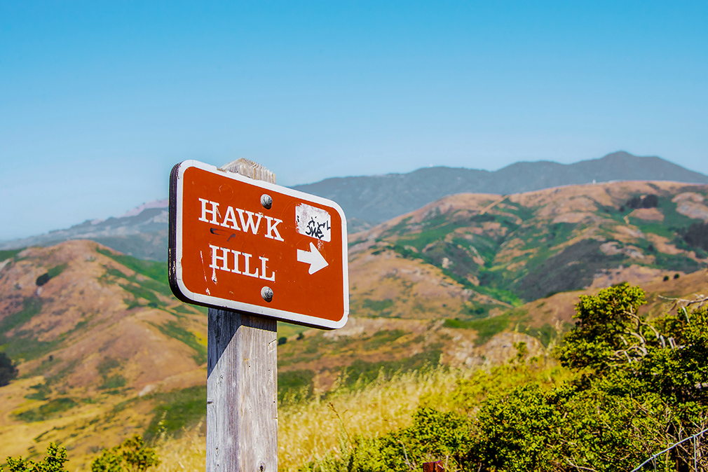
Hawk Hill, Sausalito
“Amazing views of the sun rising over SF, Angel Island, and the Golden Gate. You can drive up to to a parking lot at the top of the hill or take a quick one-mile RT hike to the top of Hawk Hill. There’s lots of open space to set up your tripod and enough service to get your Insta post up.
If you’re leaving from SF, head over the bridge and exit onto Alexander Ave. Make the immediate left under the overpass and you’ll be on the road to Hawk Hill. There’s a parking area just below the gate leading up to Hawk Hill. From the parking lot you can walk west about ten yards along the outside of the guard rail to take a well-worn use trail out to a spur overlooking Point Diablo. The views here are fantastic and have no crowds.
If you get there before sunrise, you have about a 1-mile hike up to the top of Hawk Hill. If you luck out and the rangers have already opened the gate, you can drive almost to the top. From the upper parking lot, there’s a fire road that’s less than a quarter mile up to an old bunker. This is the best place to take in the sunrise. Get your tripod, GoPro, or phone all set up, then sit back and relax. We highly recommend bringing a thermos with your favorite coffee; it’s not always the warmest up there.
It’s also good to bring a windbreaker or a warm blanket, the area is very exposed. As you’re driving out on the way back down, there’s also a good lookout on Conzelman Rd. You’ll see a parking lot to pull out to and most likely a few other photographers. This is a great spot to catch the sun passing through the arches of the bridge.”
Matt Davis-Steep Ravine Loop, Stinson Beach
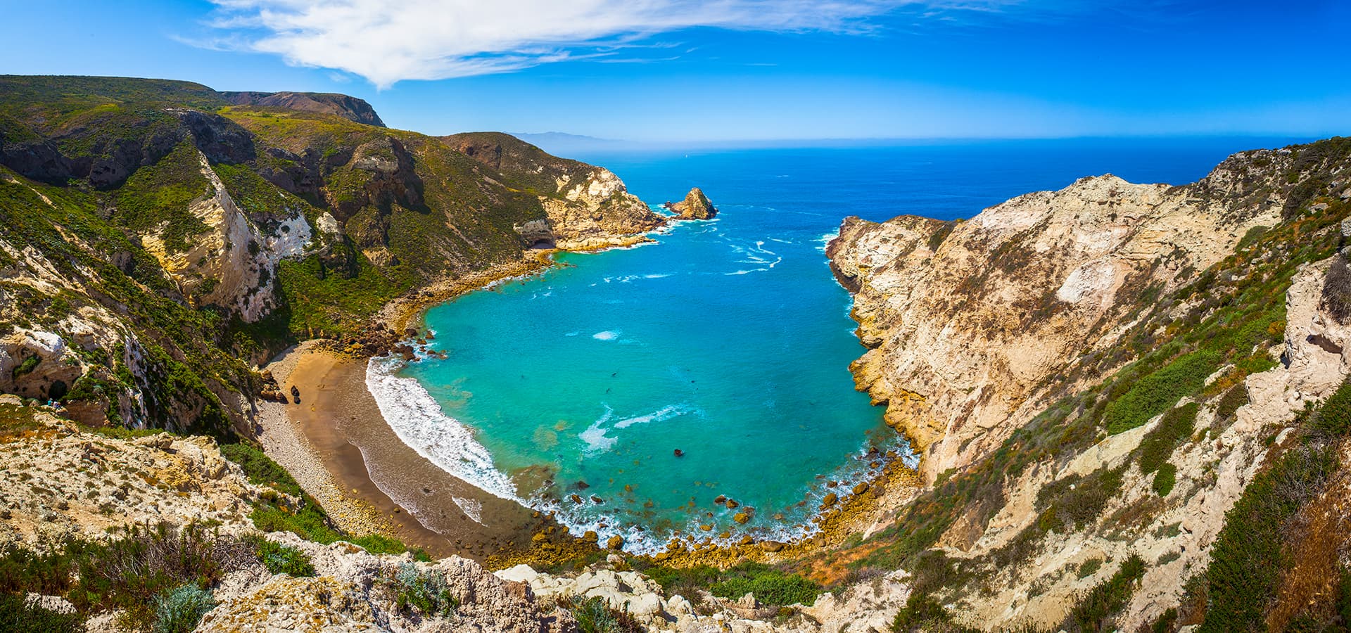
“Hike a loop on Mt. Tamalpais covering two of the most famous bay area trails: Dipsea and Steep Ravine. Experiencing amazing views of Pt. Reyes, the Pacific Ocean, waterfalls, and wildflowers.
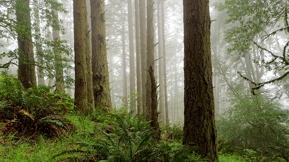
This loop is made up of three of the most popular Marin trails and for good reason. These trails offer not only expansive ocean views, but a variety of topography and environments. This 6+ mile loop offers up waterfalls, dense forests, redwoods, and open grasslands overlooking the pacific. Starting from the Stinson Beach Trailhead behind the fire station, you will cross over an old, wooden bridge and begin the ascent up the Matt Davis Trail. The trek upward may feel like it never ends, but just at 2.5 miles, you’ll receive a little reprieve. Stay on the Matt Davis trail, and head to the clearing, where you can enjoy ocean views, sights of Marin and SF.
As you exit the grassland, you’ll cross over the Panoramic Highway, reaching the Pantoll Campground. Keep an eye out for traffic! Once you see the sign for the Steep Ravine Trail (downhill to your right before crossing Pantoll Rd. or Deer Park Fire Rd.), start your descent along the canyon wall. When you reach the top of the ladder on Steep Ravine, stop and get your obligatory photo opp in. Continue on Steep Ravine until you reach the Dipsea at approximately 6 miles in.
Once on the Dipsea, take the trail the remaining mileage back to the parking lot.
Print out the Tamalpais State Park Map before hitting the trail.”
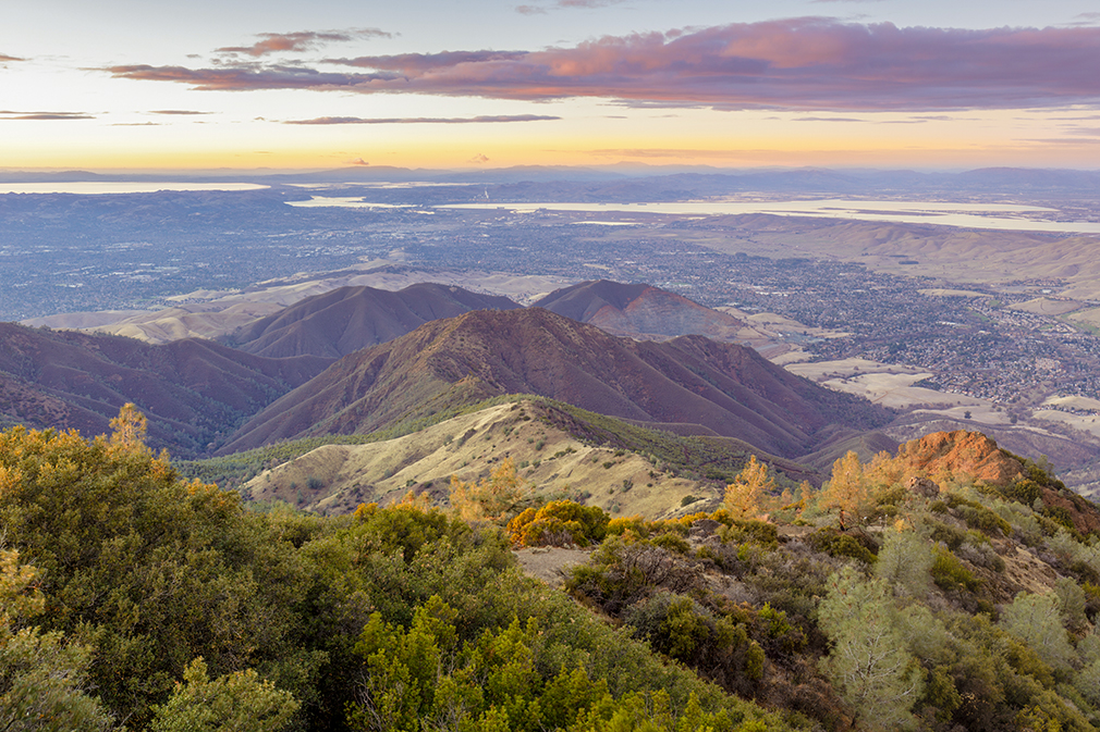
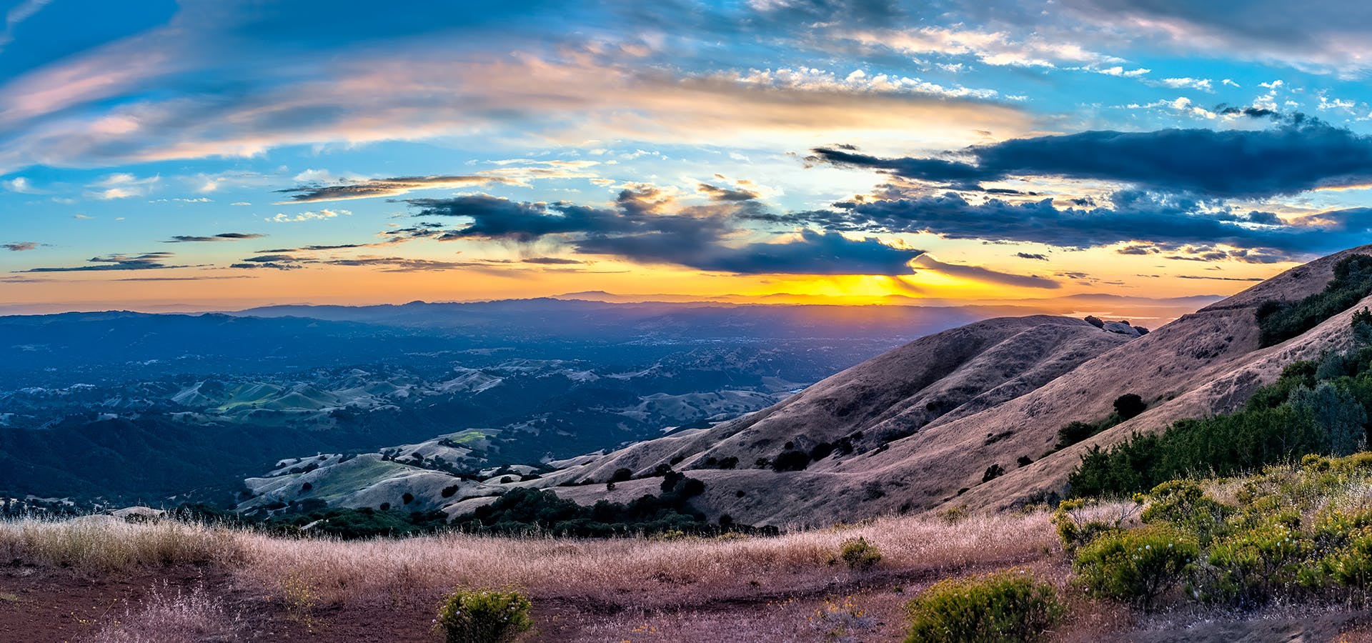
Mt. Diablo, Clayton
“If you make this hike you’ll have bragging rights for reaching the top of one of the Bay Area’s tallest mountains at 3,849 feet. This makes for a great training spot for Half Dome or Whitney. Heads up there is a small fee to enter the park.
Mt. Diablo has some of the most expansive views in California, despite it’s relatively low peak elevation. It played a large role in the surveying the Bay Area during its early discovery.
To get to the staging area, take Interstate 80 to I-680 to Highway 4. Exit at Railroad Boulevard in Pittsburg. Drive 4 miles over the foothills. Railroad turns into Kirker Pass Road. Turn left onto Clayton Road. Go 1 mile to Mitchell Canyon Road and turn right. Mitchell Canyon ends at the trailhead.
Once you’ve parked and made it to the trailhead, get your backpack all set with water, snacks, optimism—it’s going to be a bit of a trek. The leg to the summit is 6.8 miles and full of elevation change.
From the trailhead, head 4 miles on the Mitchell Canyon fire road. After 4 miles, you’ll reach a fork leading to either Meridian Ridge or Deer Flat Rd. Head to the right on Deer Flat Rd for approximately 1.5 miles until you reach the Juniper Campground. Head through the campground parking lot and keep an eye out for the sign to the summit. Take the single-track trail to the lower summit. At the lower summit you may think to yourself, ‘why didn’t I just drive the car up here?’ The short answer is that it would be too easy! Take a couple minutes here to hydrate and grab a snack. Once you’re ready to head back, go right on the Summit Trail, then hang a left on the North Peak Trail for about 3 miles. Turn left on Prospector’s Gap, then right on the Meridian Ridge fire road. Turn left at the single-track Back Creek Trail for 2 miles to the Bruce Lee Trail. Head left from there and you will be back at the trailhead and your car shortly thereafter.”
Get full list of pre-Turkey Day hikes HERE: