


Not to be overshadowed by its handsome neighbor, Sequoia National Park, Kings Canyon offers some of the Golden State’s best scenery for both beginner and advanced hikers. According to Backpacker.com, the park was first protected in part as General Grant National Park in 1890. “Kings Canyon became a national park in 1940, and counted photographic luminary Ansel Adams among its early supporters. It is known for its huge sequoia trees, including the gigantic General Grant Tree in Grant Grove.”
Here’s are three Backpacker.com’s recommended trails:
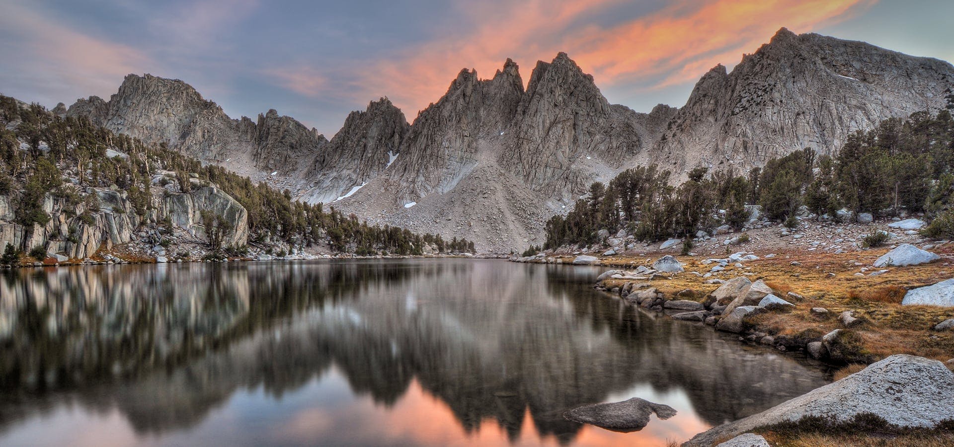
Rae Lakes Loop
“For a multi-day hike, the Rae Lakes Loop is a winner. One of the most popular hikes in Sequoia and Kings Canyon, trail quotas often fill up during the summer, so consider making a reservation for this 41.4 mile loop. You will also need a wilderness permit, which will be issued at the Roads End station, 5.5 miles beyond Cedar Grove.
“Throughout the course of the trail, you will climb from 5,035 feet at the trailhead to 11,978 feet at Glen Pass. Creek crossings can pose a problem in the early season of May and June, depending on the snow year, so make sure you’ve brushed up on how to safely cross moving water, and be prepared to turn around if things get too spicy.
“Due to this trails popularity, there are limits to how many nights hikers can stay at certain lakes. You’ll also need to store your food in a bear canister.”
Mist Falls
“For a longer dayhike, the 9-mile trail to Mist Falls links woodlands, wildflower-strewn meadows, and views of a surging river, gaining a modest 600 feet along the way, mostly over the last mile to the falls. After making your way through a marshy area, you’ll come upon Bubbs Creek. Stay on the trail for Mist Falls, as another branch of the trail will take you into the Kings Canyon backcountry.
“The final portion of the trail to the falls gets steeper and rockier as it hugs the Kings River. (While the pools of water forming between the cascades and rapids in the river may look inviting, fast currents and cold water make swimming hazardous.)
“Continue on the trail on a natural granite staircase that eventually leads to the falls. Take in the views from flat, granite boulders along the way and then pop out past the waterfall to Paradise Valley where you can camp and eventually connect with the Pacific Crest Trail if you are so inclined.”
John Muir Trail
“For those looking to get in a portion of the John Muir Trail, which extends from Mount Whitney to Yosemite National Park, check out the 83.7 miles that go through Kings Canyon National Park. Generally most accessible from July-September, depending on the snow year, this portion of the JMT can be busy, but if planned correctly, it’s a beautiful way to get a taste of the trail. Highlights include high-altitude oasis Big Pete’s Meadow and rocky, 11,760-foot Kearsarge Pass.
“The easiest way to connect to this portion of the JMT is from Devils Postpile National Monument, near Mammoth Lakes, CA. A wilderness permit is required for all treks.
“All of the above-mentioned trails are best hiked in the spring, summer and fall. Kings Canyon National Park is in the Sierra Nevada Mountains, which are known for heavy snowfall in the winter, often making trails inaccessible.”
Get all six recommended hikes here.